Yosemite National Park
Experience the wild heart of Yosemite National Park on a professionally guided backpacking trip or mountain climb. From granite summits to high alpine lakes and quiet backcountry camps, our Yosemite guided hiking tours will show you the wilderness. We handle the backpacking permits and logistics—you focus on the experience.
Backpacking Trips for 2026
We are offering multi-day trips for…
Half Dome via the Cables route
Tuolumne Meadows to Sonora Pass
Continue scrolling for more details…
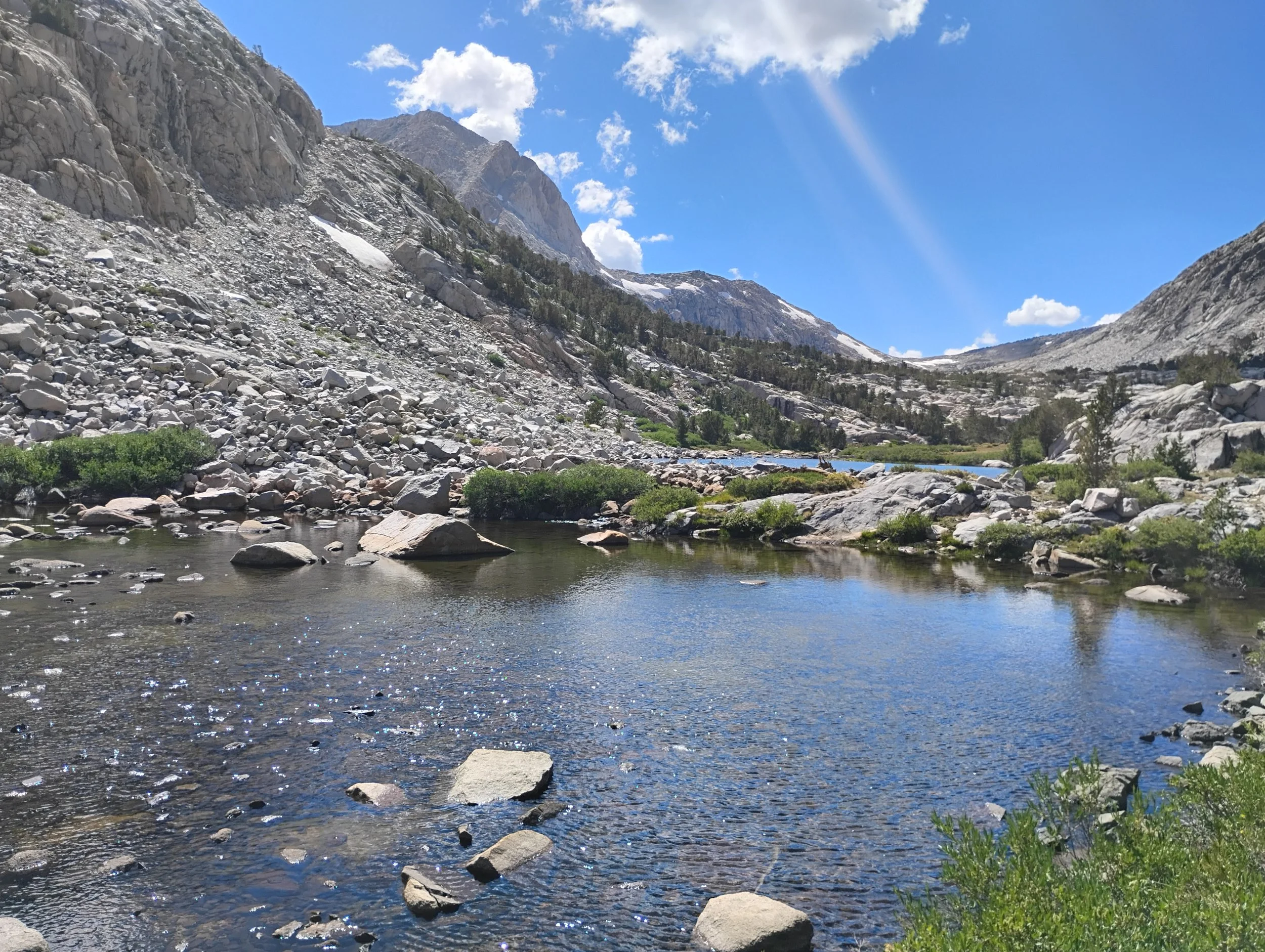
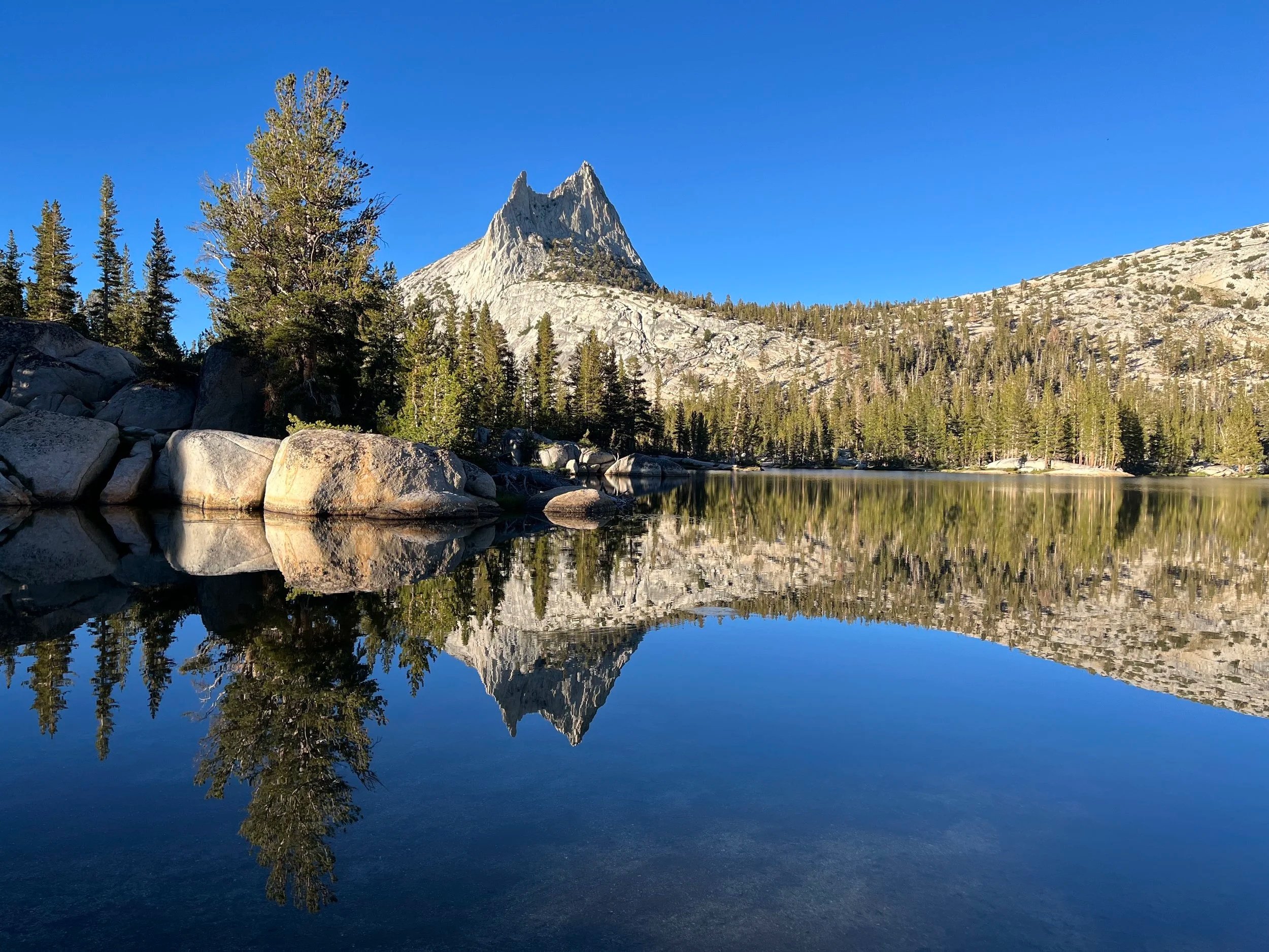
Half Dome via Sunrise Lakes & Clouds Rest
Summiting two of Yosemite’s most Iconic Summits
Approx. 30 miles round trip | 3 Days
This unforgettable high route through Yosemite National Park links alpine solitude with one of the most iconic summits in the range.
We begin at the Sunrise Lakes trailhead, climbing steadily into the high country to camp near the pristine Sunrise Lakes on night one. Day two carries us across open granite and airy ridge lines to the summit of Clouds Rest (9,900’), where the Sierra opens in every direction. From there, we descend toward the shoulder of Half Dome to make our camp near Sunrise Creek.
Before dawn on day three, we rise early and move toward the cables route on Half Dome (8,800’). Climbing the cables in the quiet morning light, we reach the summit just before sunrise, standing high above Yosemite Valley with sweeping views and remarkably few crowds. After soaking in the sunrise, we begin our descent. After maybe another cup of coffee, we break camp and continue down to Happy Isles, completing a true high-country traverse from alpine lakes to the heart of the Valley.
This trip blends backpacking, big views, and a classic summit… an ideal objective for strong hikers seeking a bold Yosemite experience.
Trip Essentials:
Each trip includes:
All meals from lunch on Day 1 through lunch on Day 3
All permits and wilderness logistics
Professional guiding with deep knowledge of Sierra geology, ecology, and history
Tents and all group cooking/camp gear
Shuttling from end point back to the start, or vice versa
Max group size: 6 guests per 1 guide
Prices start at;
$925 per person for 3-days
2026 Summer Dates will be posted after April 11th
Tuolumne Meadows to Sonora Pass
Yosemite to the Northern Sierra Crest
Approx. 73 miles | 7 Days
This 7-day journey links the iconic high country of Tuolumne Meadows in Yosemite National Park with the rugged, lesser-traveled terrain north of the park boundary, finishing at Sonora Pass. Following sections of the Pacific Crest Trail and historic Sierra routes, this trip offers a quieter, more expansive take on the range.
From the polished granite and cascading waters of Tuolumne Meadows to remote alpine basins, hidden lakes, and windswept passes, this route showcases the full spectrum of the northern Sierra. Designed for experienced backpackers ready to take the next step, this itinerary has big mileage days with the goal to cover a lot of remote wilderness while also enjoying the mountains. With the expert guidance from RCMG, fit backpackers will find it easy to maintain a comfortable pace while saving time to explore, swim, and take in the Yosemite wilderness.
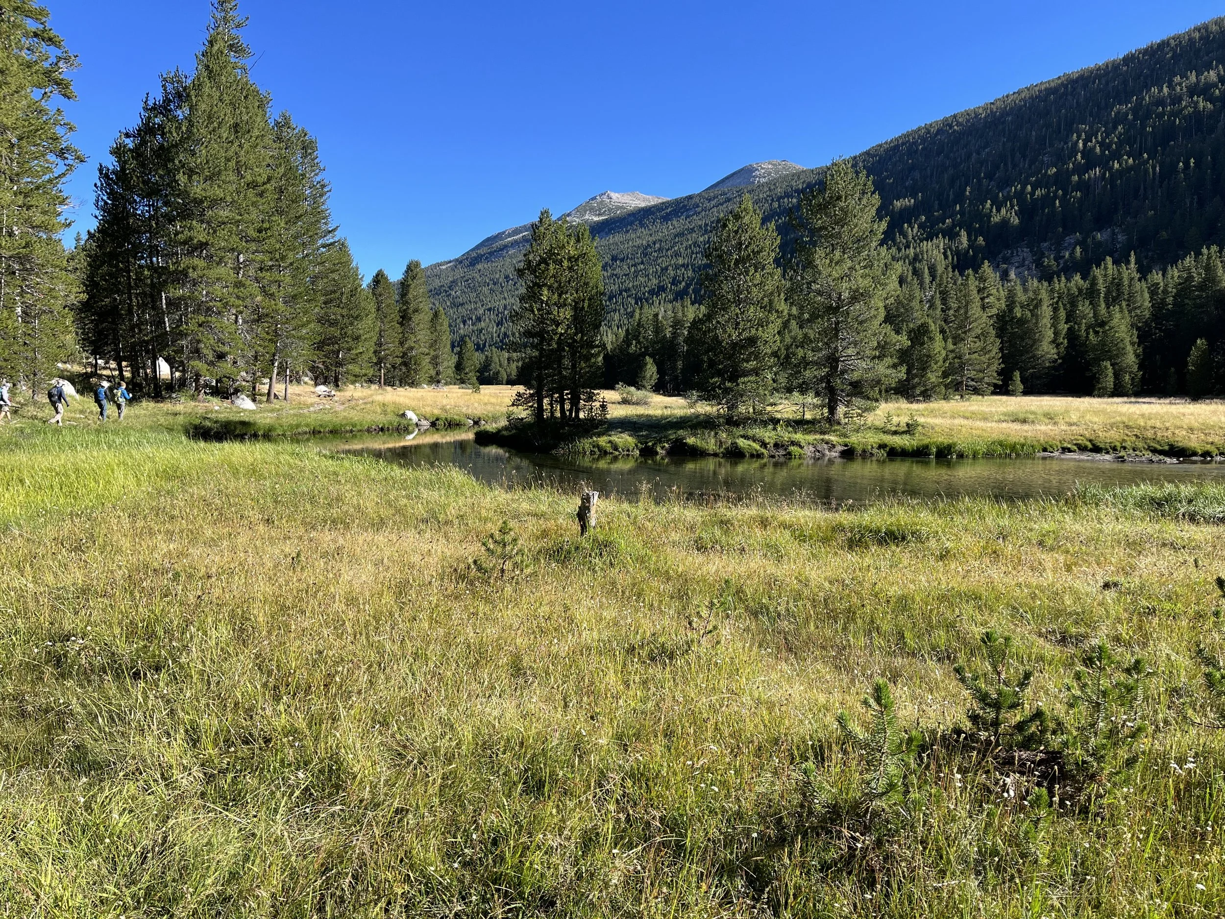
Day 1 – Tuolumne Meadows to Glen Aulin
6 miles | -800 ft, +200 ft
We begin in Tuolumne Meadows, easing into the trip along the Tuolumne River as it winds through open alpine meadows. The trail is gentle and welcoming, and an ideal first day to dial in packs, pacing, and trail rhythm.
We arrive at Glen Aulin High Sierra Camp, perched above the river as it begins its descent into the Grand Canyon of the Tuolumne. Time permitting, we explore nearby cascades and settle into our first night in the high country.
Day 2 – Into the Northern Backcountry (Spiller Canyon Area)
~9 miles | +1800 ft, -800 ft
Leaving Glen Aulin, we turn north and begin our transition away from the main canyon corridor. The trail climbs steadily through forest and granite benches, gradually leaving behind the well-traveled Yosemite terrain. As we move toward the remote reaches near Spiller Canyon, the landscape opens into quieter basins and meadows. This is our first taste of true solitude.
We camp near water in the Spiller Canyon area, surrounded by open sky and rolling alpine terrain.
Day 3 – Spiller Canyon to Smedberg Lake
~10 miles | +2800 ft, -2400 ft
Today’s route undulates through a mix of forest, granite slabs, and meadow systems as we continue northward. The terrain feels increasingly remote, with fewer signs of heavy travel.
We arrive at Smedberg Lake, a beautiful alpine lake set against rugged granite backdrops. This is an ideal spot for an afternoon swim, lakeside relaxation, and a peaceful evening in one of Yosemite’s quieter corners.
Day 4 – Smedberg Lake to Stubblefield Canyon
~12 miles | +3000 ft, -3500 ft
We continue north through rolling terrain before descending into the upper reaches of Stubblefield Canyon. The trail weaves between granite outcrops and forested stretches, with occasional openings that reveal the broader terrain ahead. As we lose elevation, the canyon environment becomes more defined, with water shaping the landscape around us.
We camp near the canyon, enjoying another remote and quiet Sierra night.
Day 5 – Stubblefield Canyon to Dorothy Lake
~12 miles | +2000 ft, -2100 ft
Today marks a transition back into higher alpine terrain. We climb steadily out of Stubblefield Canyon, gaining elevation as the forest thins and the views begin to stretch in all directions. Our destination is Dorothy Lake, sitting near the boundary of Yosemite and the open Sierra beyond. The lake is expansive and often windswept, with a distinctly alpine feel.
Camp here offers big skies, cool air, and a strong sense of being on the crest of the range.
Day 6 – Dorothy Lake to Leavitt Lake
~14-16 miles | +3400 ft, -2500 ft
We continue north along the crest, crossing into more exposed and rugged terrain. The trail traverses open slopes and high basins, with sweeping views that stretch deep into the northern Sierra. We descend toward Leavitt Lake, a stunning high-elevation lake surrounded by peaks and open ridgelines.
This is our final night in the backcountry… an ideal place to reflect, relax, and take in the vastness of the terrain we’ve crossed.
Day 7 – Out to Sonora Pass
~8 miles | +1000 ft, -2000 ft
Our final day brings a steady climb back toward the crest before descending to Sonora Pass. The terrain remains open and expansive, with wide views and a sense of completion as we near the trailhead.
We finish at Sonora Pass, having completed a true point-to-point journey across some of the Sierra’s most varied and remote terrain.
This route offers a step beyond classic Yosemite trips… less crowded, more remote, and deeply immersive. It blends iconic high country with seldom-visited terrain, creating a journey that feels both approachable and adventurous.
Perfect for those ready to expand their backpacking experience, this trip delivers quiet trails, alpine lakes, sweeping vistas, and seven unforgettable days in the Sierra Nevada.
Trip Essentials:
Each trip includes:
All meals from lunch on Day 1 through lunch on Day 7
All permits and wilderness logistics
Professional guiding with deep knowledge of Sierra geology, ecology, and history
Tents and all group cooking/camp gear
Shuttling from end point back to the start, or vice versa
Max group size: 6 guests per 1 guide
Prices start at;
$2450 per person for 7-days
2026 Dates
August 17-23
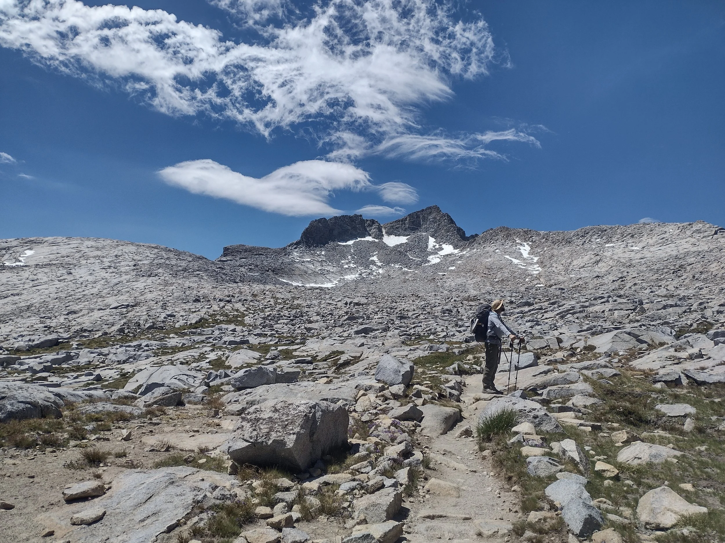
Mt. Lyell via Lyell Canyon
Summiting the High Point of Yosemite National Park
Approx. 30 miles round trip | 3 Days
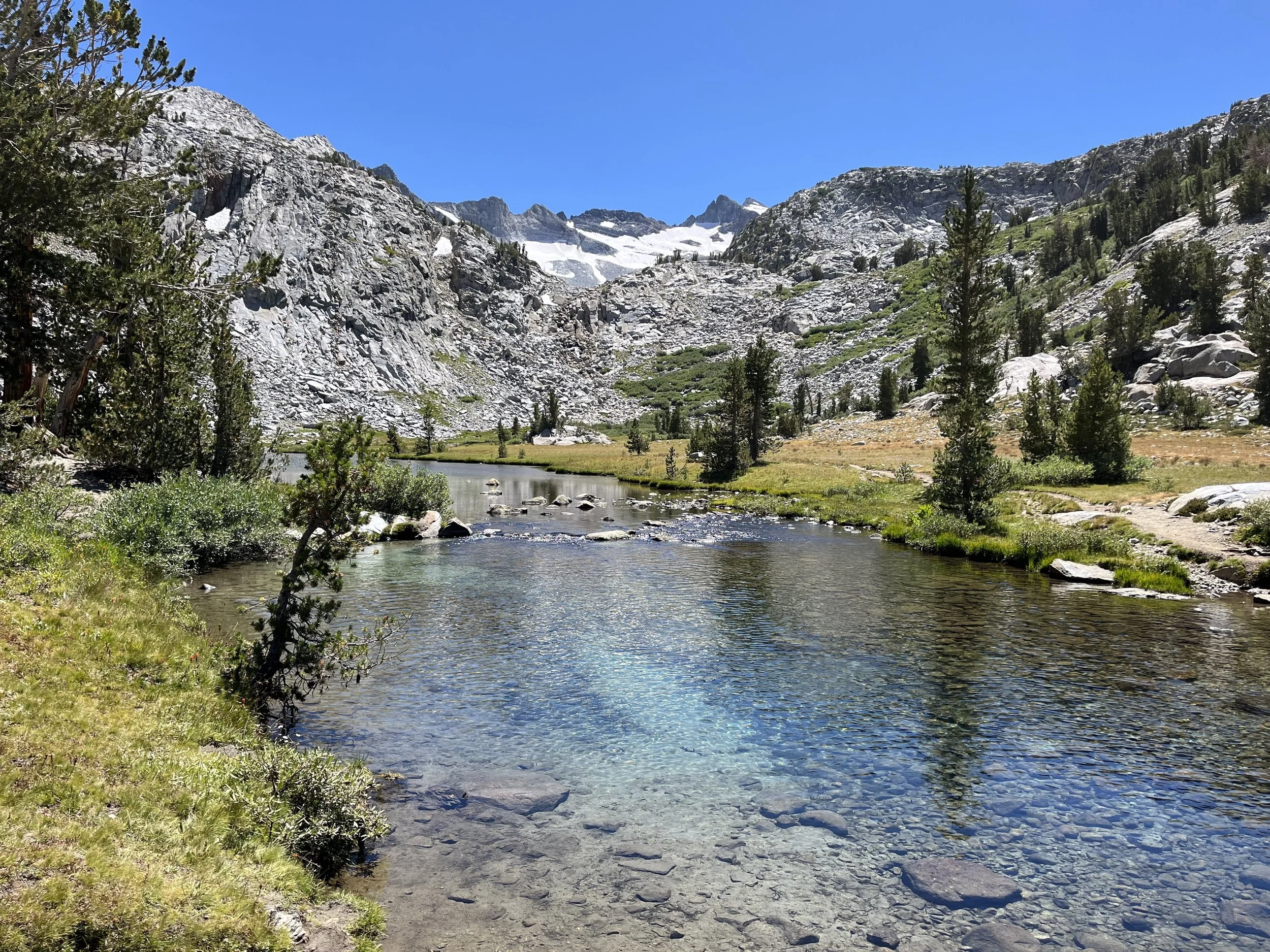
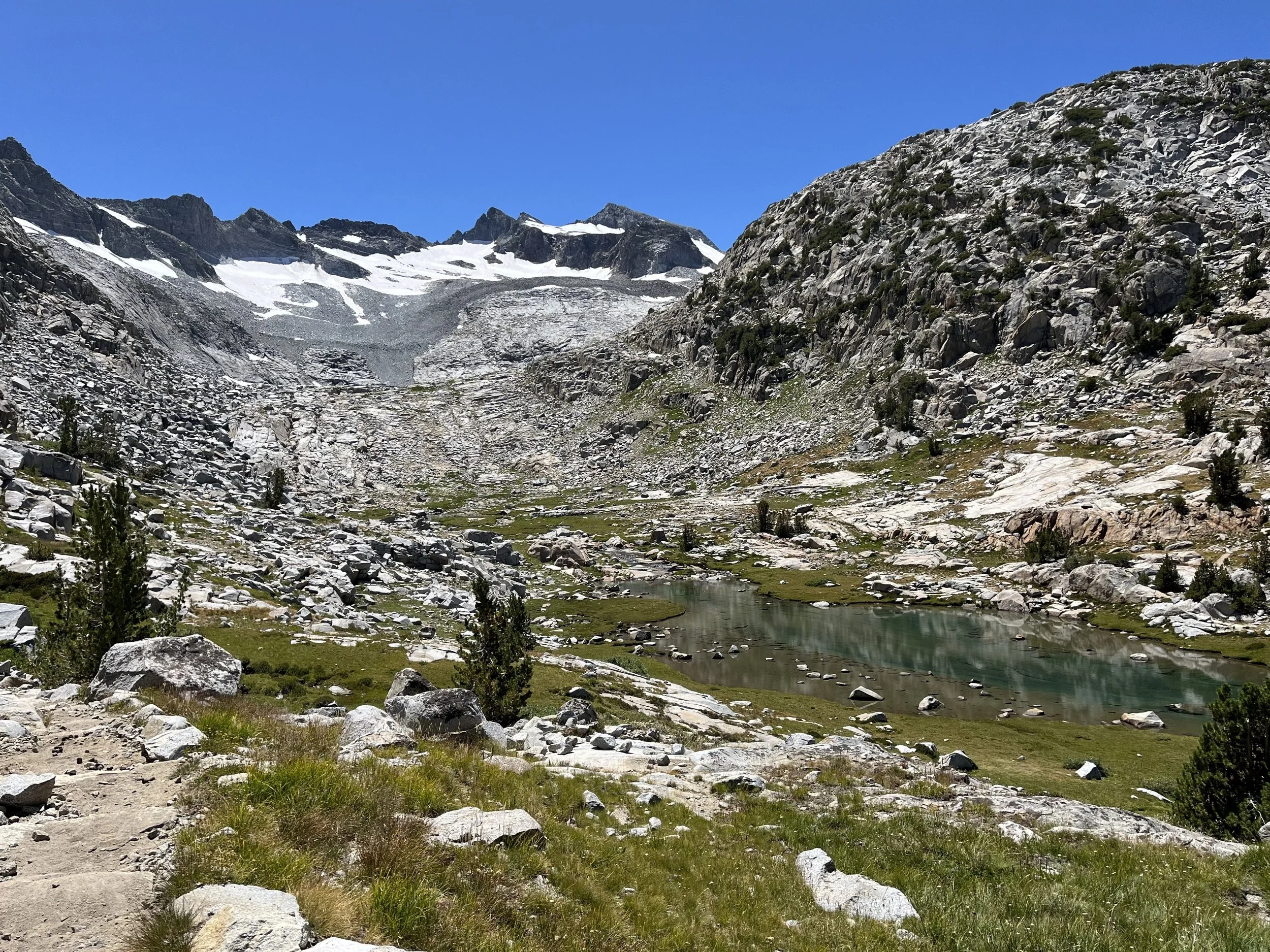
This classic high-country objective begins in the heart of Tuolumne Meadows and follows the sweeping curves of the Lyell Fork through one of the most beautiful glacial canyons in Yosemite National Park. With open granite walls, winding river meadows, and the Cathedral and Kuna Crests rising overhead, Lyell Canyon offers a stunning and gradual approach to Yosemite’s highest peak: Mount Lyell (13,114’). This trip features the Lyell glacier, one of the last living glaciers in the Sierra Nevada, and the glacier that John Muir studied in the 1870s with wooden stakes and horse hair!
Day 1 – Into Lyell Canyon
~9–10 miles | +1,200 ft
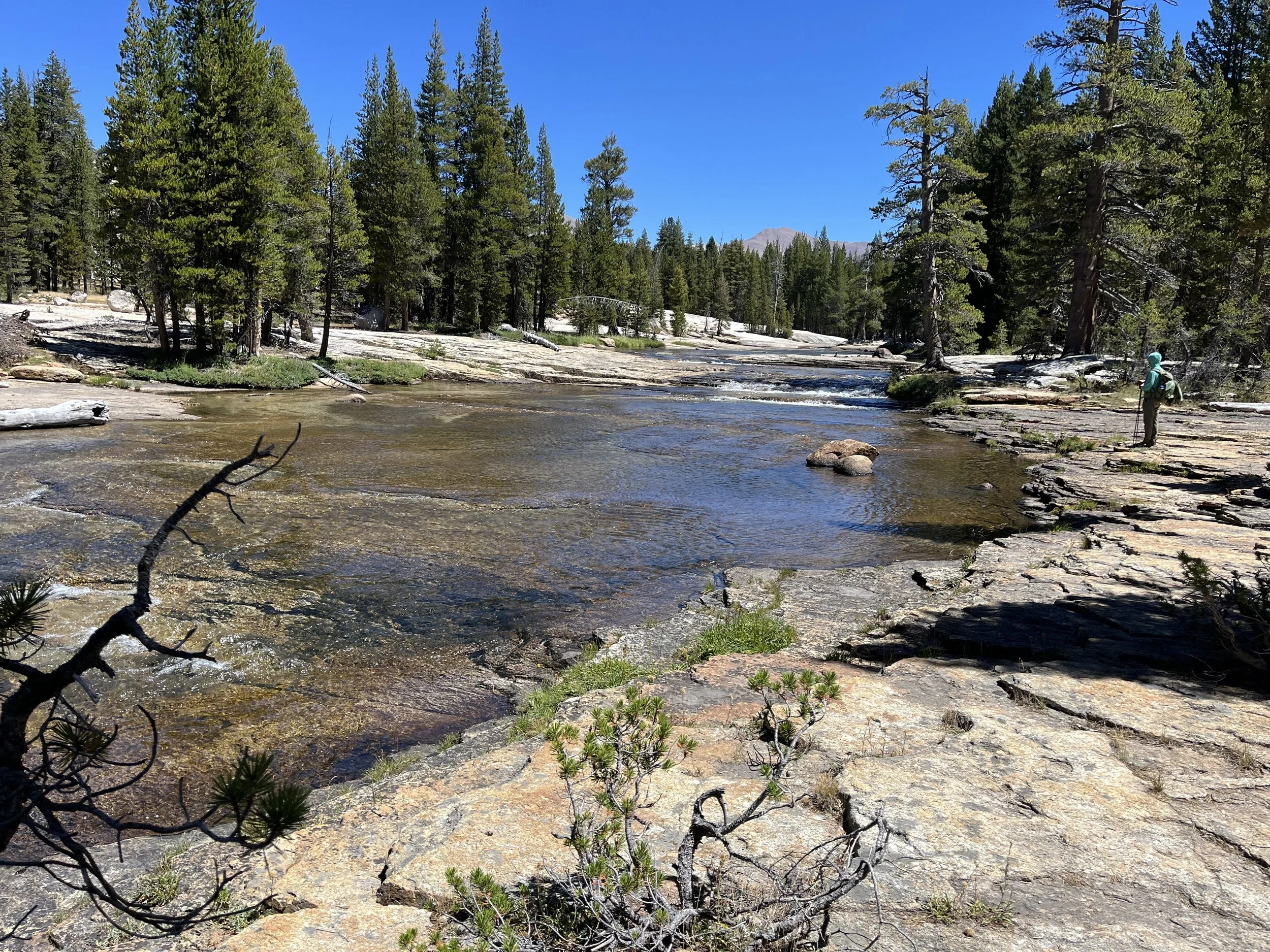
We depart from Tuolumne Meadows and hike south along the Lyell Fork of the Tuolumne River. The trail rolls gently through wide alpine meadows, lodgepole forest, and expansive granite scenery making for one of the most pleasant approaches in the Sierra. We establish camp in the upper reaches of Lyell Canyon, positioning ourselves for an early alpine start.
Day 2 – Summit Mt. Lyell (13,114’)
~8–9 miles round trip from camp | +3,000–3,500 ft / –3,000–3,500 ft
Before sunrise, we leave camp and head toward the Lyell Glacier basin. The route transitions from trail to alpine terrain as we ascend toward the saddle between Mt. Lyell and Mt. Maclure. The final stretch involves sustained snow travel early season or stable alpine rock later in the summer.
From the summit, the highest point in Yosemite, the Cathedral Range, Ritter Range, and vast Sierra Nevada unfold in every direction. After celebrating on top, we descend carefully back to camp for a well-earned rest.
Day 3 – Return to Tuolumne Meadows
~8-10 miles | –1,200 ft
We break camp and retrace our steps down Lyell Canyon, moving at a relaxed pace back toward Tuolumne Meadows. The gentle downhill grade offers time to reflect on the summit and take in the quiet beauty of the canyon once more.
This trip combines a scenic wilderness approach with a true alpine summit, making it an ideal objective for strong hikers looking to stand on Yosemite’s highest peak while traveling through one of its most breathtaking landscapes.
Trip Essentials:
Each trip includes:
All meals from lunch on Day 1 through lunch on Day 3
All permits and wilderness logistics
Tents and all group cooking/camp gear
Professional guiding with deep knowledge of Sierra geology, ecology, and history
Max group size: 6 guests per 1 guide
Prices start at;
$925 per person for 3-days
2026 Dates
June 5-7
July 17-19